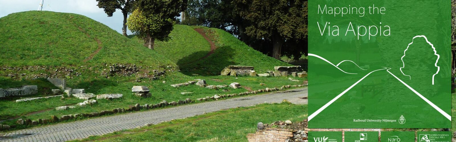
The Mapping the Via Appia project is a multi-disciplinary research project that aims to document, study and valorise the archaeological remains in and around the fifth mile of the Via Appia.
The Via Appia, ‘Queen of Roads’, became a hallmark of the political and cultural presentation of the city of Rome as the centre of the then existing world. Still today, it is still seen as an iconic monument of ancient Rome. Since 2009, the department of Classical Archaeology of the Radboud University Nijmegen has started a field work project in close collaboration with the Royal Netherlands Institute in Rome, named ‘Mapping the Via Appia’. The project aims at a thorough inventory and analysis of the Roman interventions in their suburban landscape, focusing on parts of the 5th and 6th mile of the road. The stretch starts where the modern Via di Erode Attico crosses the Via Appia Antica and ends at the intersection with the Via di Casal Rotondo.
The wealth of archaeological monuments preserved both above and beneath ground level, as well as the opulent documentary evidence in archives and digital resources (mainly photographs), enable a very detailed multidisciplinary analysis of the history of the road and its surroundings. At the same time, this huge amount of wide-ranging data also poses some important methodological challenges and requires the development of new documentation and analysis strategies. The complex architectural design of several monuments, as well as the detailed archival records, have resulted in an archaeological and historical landscape that cannot be studied by only using established recording systems hitherto employed in for example regional field survey projects.
Therefore, the project uses a new and innovative research strategy designed especially for the efficient recording and study of complex and monumental archaeological landscapes with long occupational histories. The project has been divided in five main research methods: an inventory of the architectural remains along the Via Appia; archaeological excavations; field surveys in the direct hinterland combined with geophysics and remote sensing techniques; archival studies and the creation of a 4D GIS. By combing the results of these different studies, this project will not only offer invaluable new data on the functioning of this and other Roman consular roads, but it will also provide a new methodological framework for studying monumental archaeological landscapes that can be used and further devolved on other research projects.
For more information see www.mappingtheviaappia.nl or the project’s facebook page.
Research Team
Affiliated Researchers
Helke Kammerer-Grothaus, Universität Bremen
Ryan Niemeijer, RU – pottery analysis
Filippo Salamone – pottery analysis
Rita Paris, Archaeological Service of Rome
Antonella Rotondi, Archaeological Service of Rome
Krien Clevis – Artist researcher, see also www.knir.it/nl/krien-clevis/